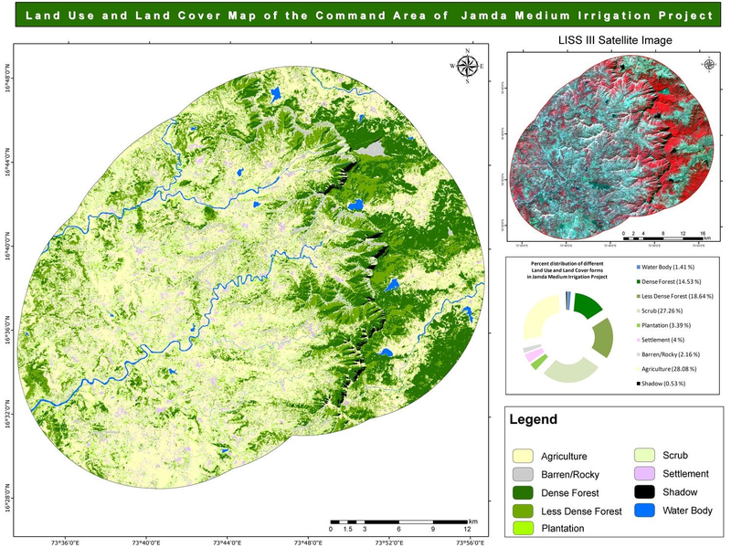
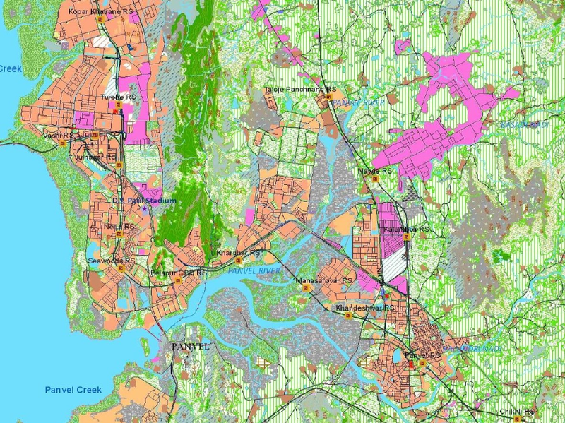
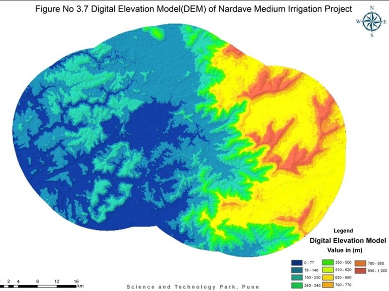
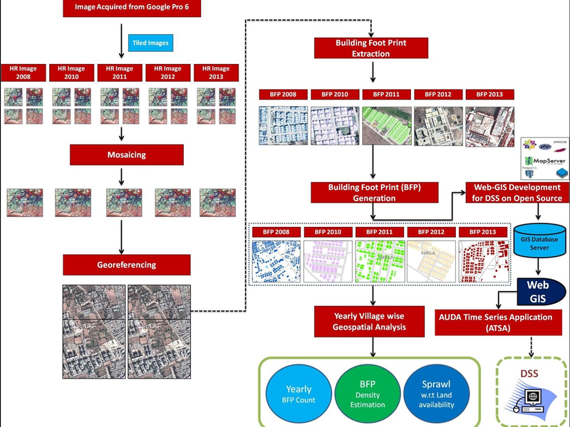
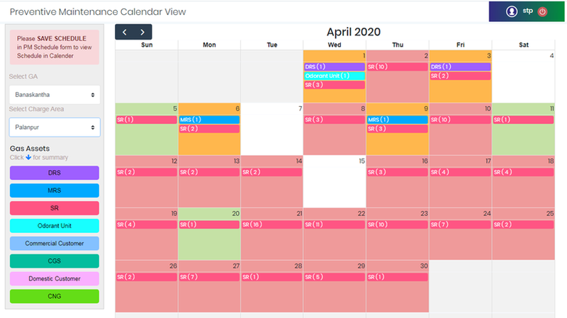
Scitech Park is providing Geospatial Mapping Solutions to different government, semi-government and private organization through a dedicated team of experienced GIS Professionals. Our expertise ranges from handling very high resolution satellite images to conducting GIS based spatial analysis. Our geospatial umbrella covers GIS for Urban and Rural Planning, archival data digitization, time variance analysis using multi temporal satellite images and risk based GIS modeling, satellite image based digital and visual classification and conducting precise ground level surveys. We strengthen our knowledge by adopting and promoting Open Source GIS technologies and have excelled in creating our own product called Open PRP Suite. Use of satellite images for mapping and inventory features on the surface of the earth are essential for understanding the complex interaction between various ecologies to form and evolve on this planet. Precise mapping has facilitated in identifying concerns and threats to earth resources be if forests, water, soil, minerals, land banks. It further enhances the scope of proper planning and resource utilization by planners and resource managers. Scitech Park Pune has been involved with diversified projects related to impact assessment using satellite images, analyzing changes using multi-temporal satellite images, mapping resources for regional and development plan, conducting habitat studies for keystone species using satellite images at its core and conducting geospatial Modelling to understand complex ecological interactions between various factors. We have in-house expertise in processing & interpreting satellite images ranging from medium to very high-resolution satellite image. Scitech Park Pune has been actively engaged with major City Gas Distribution (CGD) companies across India to map and web play their critical gas assets on a centralized geospatial platform exclusively using open source GIS tools and technologies. Mapping of gas assets on ground is taken care by our expert team of CGD surveyors involved in precise mapping of gas components using hybrid technique of Electronic Total Station (ETS) Differential GPS (DGPS) and preparing topologically correct maps with logical ends. Currently Scitechpark has ground mapped more than 250 km of steel pipelines, and 1500 km of MDPE pipelines. The proposed solution of Gas on Open PRP (GoPRP) and its derivatives are OGC compliant and has the power to integrate with Enterprise solutions like SAP. The development proposed is customized to the local CGD needs and the desktop GIS software is free from any licensing policy. The Web module of GoPRP is seamlessly integrated with Android devices for incident reporting. Currently Go PRP comes with three option Core, Pro and Pie for CGD players proposing implementation of GIS. Our system covers more than half a million customers spread across india with major presence in Gujarat (Ahmedabad, Sanand, Gandhinagar, Mehsana, Sabarkantha, Aravalli, Patan, Banaskantha, Gir Somnath & Diu), Punjab (Fatehgarh Sahib, Rupnagar), Madhya Pradesh (Dewas), Haryana (Yamunanagar), Uttar Pradesh (Saharanpur), North Goa, Maharashtra (Ratnagiri, Chiplun, Lote, Devrukh and Saverde), Karnataka (Belgaum) and Telangana states. Advent of Very High-Resolution Imaging has opened the pandoras box of earth observation and has provided insight into various untapped potential about our geography, nature and natural surroundings. Aerial Unmanned Vehicles with the power of Vertical Take-off and landing has helped in urban and rural administration, categorically demarcated lands with precision and mapped utility features with least physical hinderance. Scitech Park, Pune has its unmanned aerial vehicle specifically designed for precision mapping resources with 42 mega-pixel camera. The flight height defines the image resolution which varies from (2cm to 15 cm). UAV has been used for mapping urban settings for property tax assessment and detection of unauthorized and un-accessed properties, utility mapping w.r.t. road, railways, electrical assets etc., conducting volumetric analysis for mining areas and defining volume extraction, providing orthorectified images with DEM and DSM and helping agencies to track any activity which can impact health and environment of the society. UAVs have off late been used to conduct industrial inspection for utility companies and bringing down their work risk and outages. Mobiles enable connectivity at any time to any device at any location and Mobile solutions are the need of the day for organizations as they result in accelerated processes, more flexible working practices, greater employee productivity, better customer service due to faster issue resolution and easy accessibility. STP offers Mobile solutions for -- Enterprise, GPS Survey, Asset Management, Work process optimization(s) related. Apart from mobile business solutions we also develop diversified apps on Play which are utilizing the latest technological advancements like Augmented Reality/Virtual Reality to enhance user experience and provide a rich experience. Use of Geospatial Technology have been widely utilized by the Planners for Urban and Rural Mapping. It given them near real-time evidence of features, resources and image derivatives which is essential part of Planning and Policy Implementation. New urban area requires meticulous planning for the region so that it can enclose a smart and healthy society. Scitech Park, Pune has helped in GIS based planning for effective management of land resource, proper allocation of land use based upon development plan reservations, transparent method of dealing with asset purchase and ownership rights. We have been closely involved with various Urban Local Bodies for implementing end to end GIS wherein all their municipal assets related to water, engineering, property tax, sanitation has been mapped on ground and brought on to GIS platform. We have also closely worked with ULB’s to prepare a slum free city plan of action, helped the Town Planning and Valuation Department, Government of Gujarat in mapping through digitization, digital conversion and Web GIS display of Town Planning Schemes (TPS) into GIS and creating inventory of records thereby ensuring transparency on a public domain. Use of Geospatial Technology with the support of analytics has helped in transforming the existing paper data of industrial estates into in digital form and brining transparency of activities across all departments specially Engineering, Accounts and Allotment. Use of technology has helped in recovery of payment dues from default industries, GIS Mapping has established as is situation on the ground and helped in identifying encroachment and further helped administration for either regularization or charging the penalty to offenders after reviewing cases based on satellite image analytics evidence. Such evidences have also helped in identifying changes taking place at plot level using change detection techniques. Scitech Park, Pune has developed a customizable web GIS based Decision Support System, which displays plot-based inventory of industrial estates database, providing real-time information about dues (water and rental), plot transactions made if any, payment schedule for the accounts department displaying Engineering Departments asset data on GIS platform and a dynamic Web GIS temporal analysis along with plot-based change information module to formulate better and effective strategies and “Ease of doing Business”. Natural Disasters have caused severe damage to life and property both in urban and rural parts of India. The aftermath of such disasters is a huge burden to the national exchequer. One of the major factors affecting various parts of India on an annual basis are floods and unpredictable heavy rains. We may not control such natural disasters, however can plan and equip ourselves to reduce and minimize loss to life and property. Use of spatial technology has catered to the much-needed demands disaster management wherein they are pre-equipped with time, extent and intensity of damage. This has further helped achieving targeted approach of rescue and relief measures. Scitech Park, Pune has conducted many risk and hazard mapping activity for rainfall induced dam breach and modeled outputs to define time wise extent and intensity of damage. This has also helped us in defining risk zones based upon frequency of flooding thereby helping insurers to fix premium based upon flood frequency factor. Scitech Park, Pune provides consultancy service to Urban Local Body and Area Development Office by conducting precise ground-based survey using highly specialized Electronic Total Station Machines and DGPS instruments. Ground based precise land survey have been very helpful in creating development plan, local area plan and providing compensations and restitutions to land owners etc. We have been doing precise mapping of land and assets through detailed topographic survey and capturing all above ground features, topographic components like, contours and conducting horizontal and vertical reference through DGPS Surveys for land and utility planning and boundary demarcation. Scitech Park, Pune has provided precise survey records for Ahmedabad Urban Development Authority, Gandhinagar Development Authority, Surat Urban Development Authority and Municipal Corporation like Rajkot, Jamnagar, Bhavnagar under various local, state level and central programs. Land parcel boundary demarcation activity was taken up for most of the Cantonment Boards within the Southern Command. Scitech Park, Pune has developed their own product for Web GIS display of data in a fast and easy manner on a web browser called Open PRP (Public Resource Planning). This has vastly reduced the dependency on costly and licenses based proprietary software. Various customizations have been made to develop key Web GIS applications for urban applications like Municipal GIS, Town Planning Department, Industrial GIS, Temporal Change Analysis on Web Platform and We have improved and moved ahead by developing an exclusive enterprise level Web GIS based solutions for Utility companies specific to City Gas Distribution called Gas on Open PRP (GoPRP). These companies use our low-cost open source GIS and web-based system to manage and assess their huge datasets specific to CGD industry. The end users are able successfully conduct their O & M activities with connect resources and customers through web and android devices. Scitech Park has expertise in the domain of Enterprise Resource Planning (ERP) covering Administration, Finance, HR, Knowledge Management along-with integrated classical ERP modules like Inventory, Sales, Purchase, Production catering to several verticals of the Manufacturing Industry like Auto, Heavy machinery, Electrical etc. and also for specialized requirements of the Pharma Industry. We are engaged in providing support & services to organizations who want to digitize their Workflow for increasing efficiency by using latest technologies, thereby going towards the Paperless working environment ideology. Solutions like Document Management, Digital Office, Employee information system and many more have been developed by Scitech Park, Pune.LULC Map for EIA Study
Land Use Map
DEM
Temporal Change Analysis
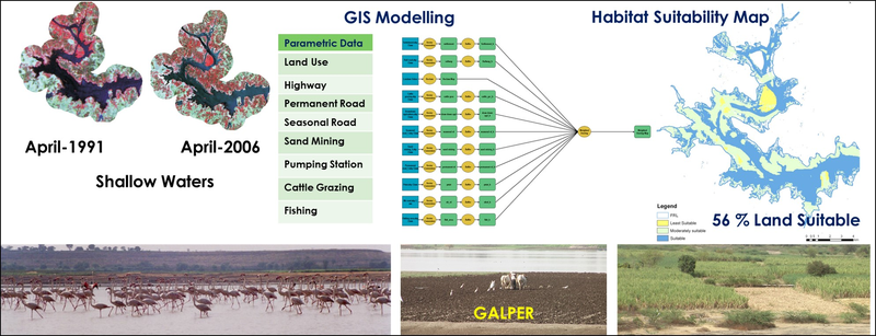
Habitat Suitability
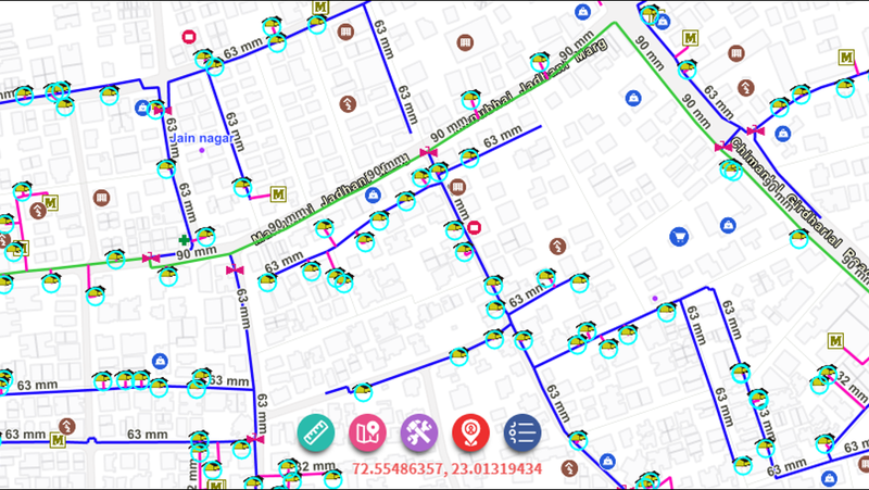
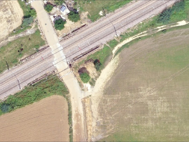
CGD Survey

CGD Survey

WEB GIS
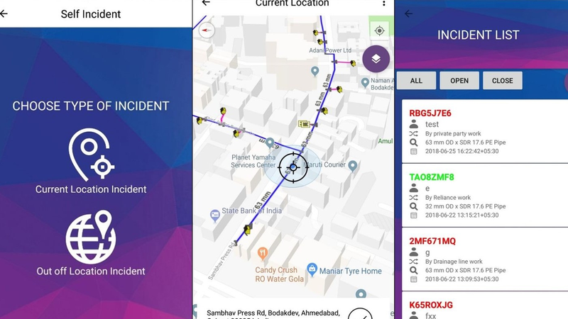
Android Interface
GIS Advantages
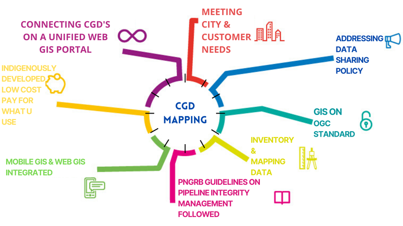
Gas On Open PRP

Urban Setting

Utility Analysis
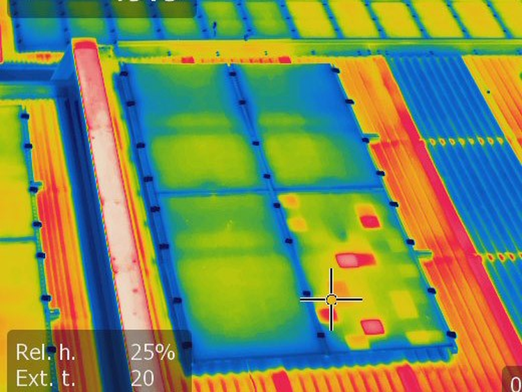
Health Hazard Mapping

Utility Mapping
Alternative Energy

Industrial Survey
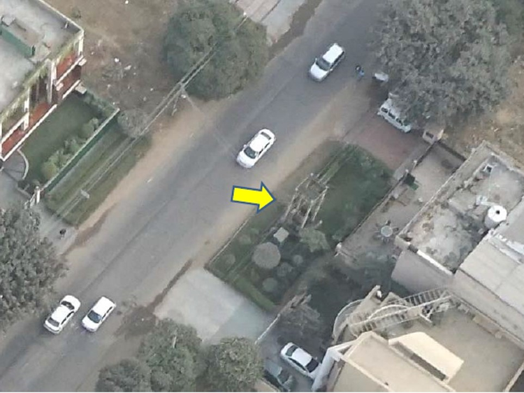
Utility Map
Android App.

Utility Map

Android App.

Aid Tracker
![]()
Aid Tracker

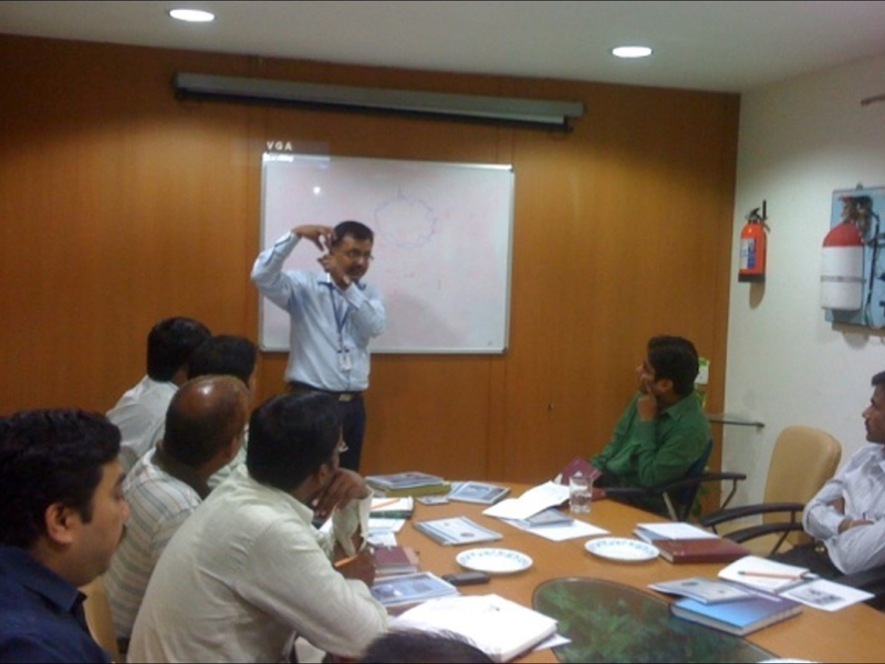
Training
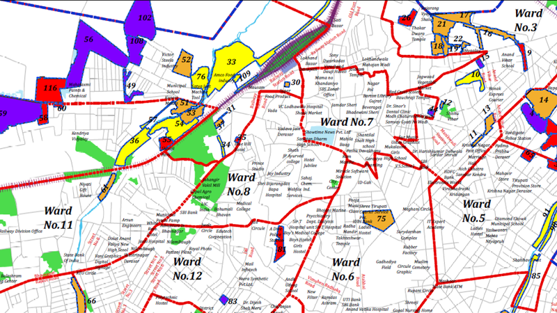
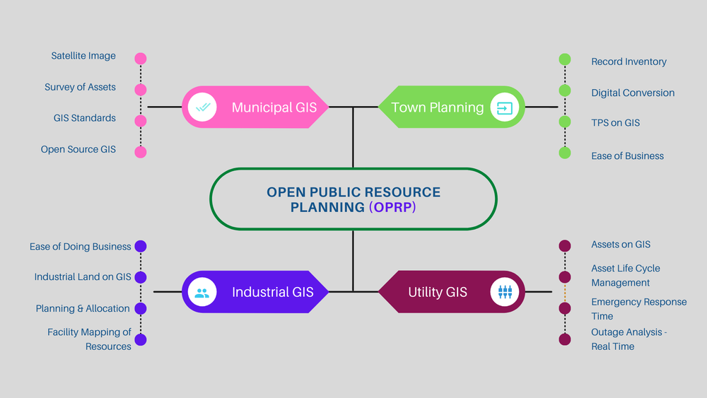
Municipal GIS

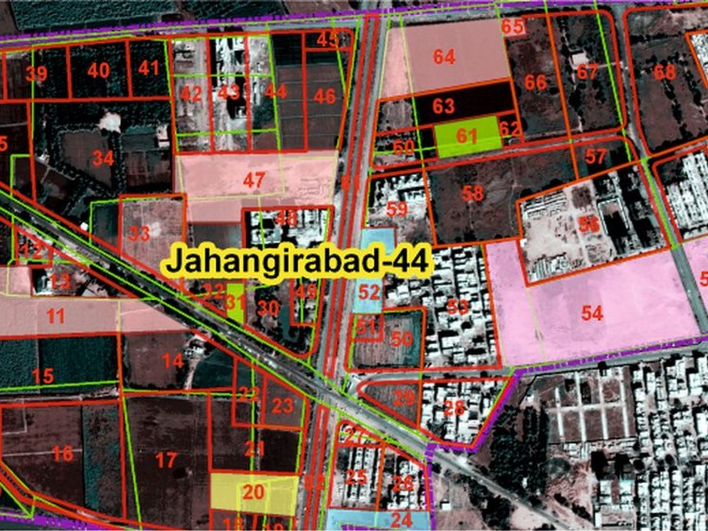
TP Scheme

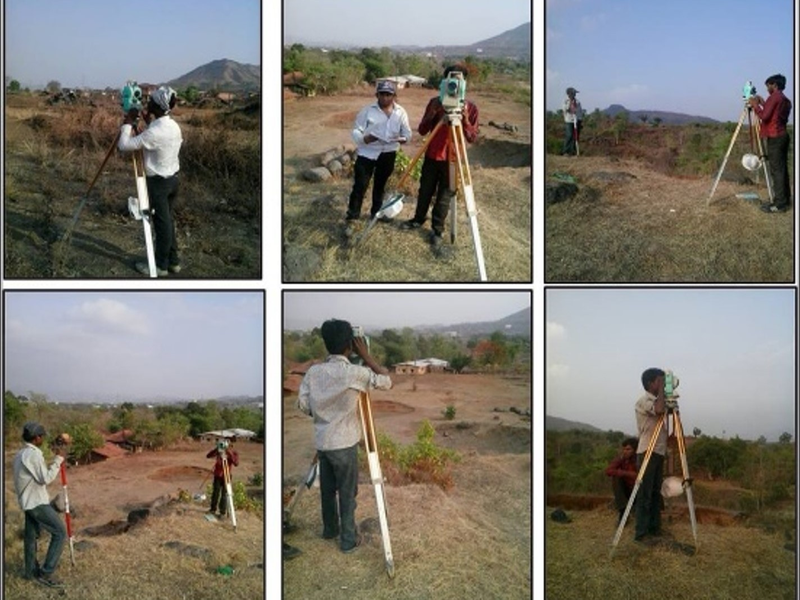
Survey
SFCPOA
TP Scheme
Industrial DSS

Temporal

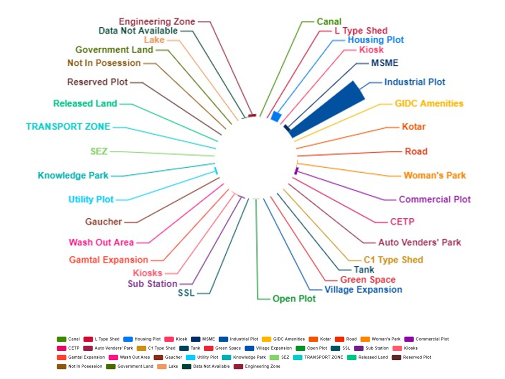
Distribution of Plots
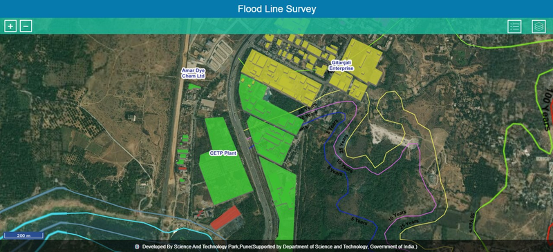
Flood Line Mapping
Lake Mapping

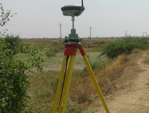
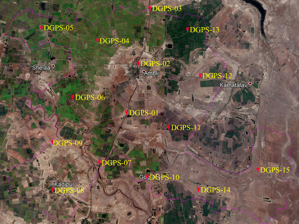
DGPS
Gulbhai Tekra Topo Model
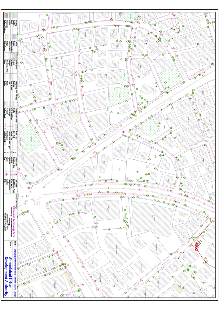
Topography Survey
Topography Survey

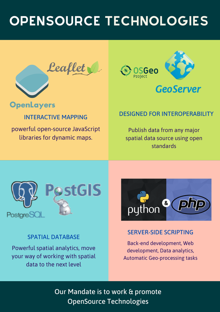

Geoinformatics
1. Earth Observation
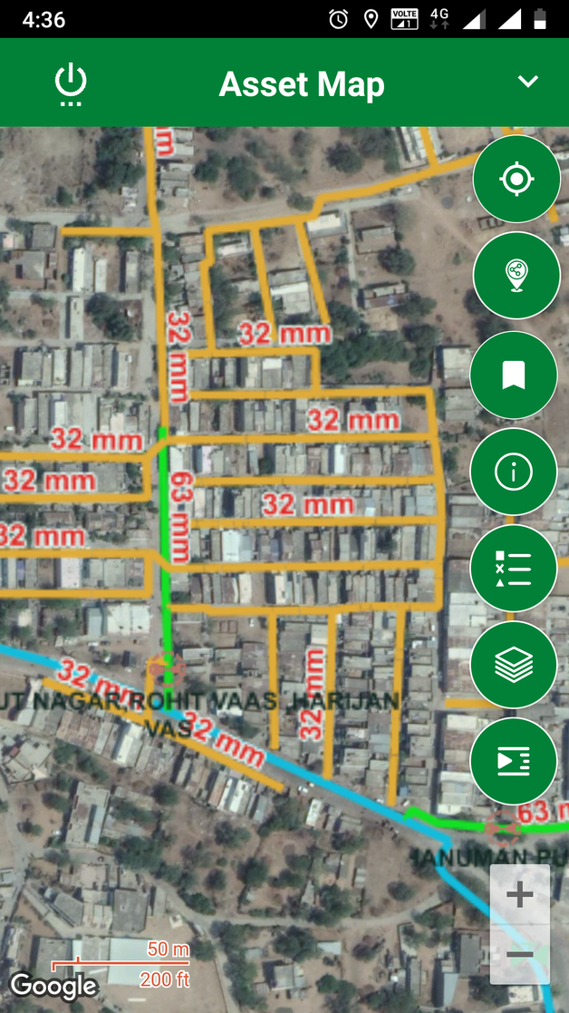
2. Utility Asset Mapping
3. Ultra-imaging using Unmanned Aerial Vehicles
4. Mobile Mapping and Use of AR and VR Technology
5. Town Planning and Urban Mapping
6. Industrial Mapping
7. Risk and Hazard Mapping
8. Precise Ground Based Survey
9. Web GIS Development
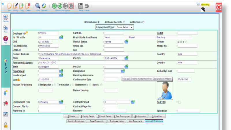
10. Enterprise Resource Planning and Other Software Solutions