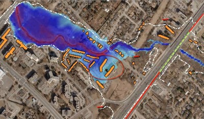
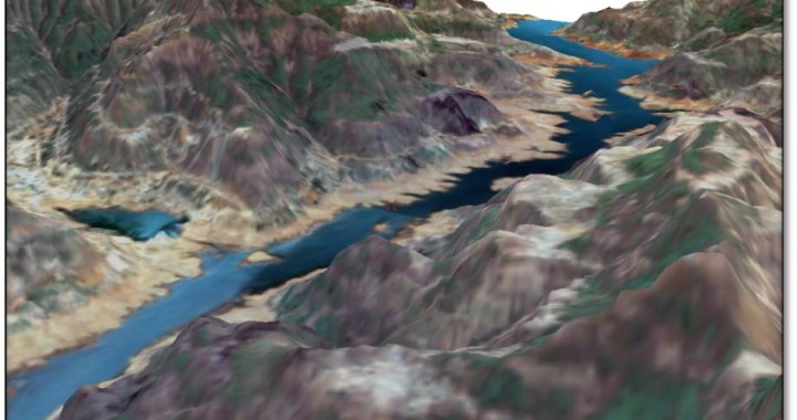
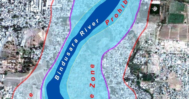
Scitech Park has constantly been working in the field of environment and provided need based as and when required to government, public and private sectors. Dedicated team of modellers and image analysts are involved in supporting environment by conducting GIS based studies in the field of environmental impact assessment, habitat loss monitoring through time series satellite data. Our team further supports by geospatially representing hazard prone areas, mapping vulnerable spots to flooding. Critical mapping of these items are achieved through generation of virtual terrain model for an area of interest.

Scitech Park is closely working with Municipal Corporations and Urban Local Bodies to collect, collates and create GIS database for various municipal departments. GIS enablement of the city municipal system has enhanced decision making process, smooth, transparent and effective with high degree of sensibility and ownership for different spatial and aspatial municipal records.
Government of India announced a National level scheme for slum dwellers and the urban poor named as Rajiv AwasYojana (RAY), aimed at creating a Slum Free India by providing support to states to assign property rights to slum dwellers. Apart from this the program acts for providing slum dwellers basic amenities to the level available in the city and readdress the failures of the previous system that leads to the creation of slums.
Field based survey using modern surveying instruments has helped us in demarcating boundary and establishing pillars as and where necessary. Need based land demarcation projects was taken up for Government and Private Bodies.Based on the requirements temporary bench marking was done and later pillars were established.
We have conducted carpet area based surveys to establish property tax regimes for cantonment board which includes physical door to door survey of all properties. The exercise was conducted by trained professional using Leica Distometer to measure carpet area of properties.

Field based survey using modern surveying instruments has helped us in demarcating boundary and establishing pillars as and where necessary. Need based land demarcation projects was taken up for Government and Private Bodies.Based on the requirements temporary bench marking was done and later pillars were established.